Vessel and Marine Data for Middle East Waters free of charge on the SeaNavigator Marine Weather Service


In response to the recent tensions in the Strait of Hormuz and the resulting rise in maritime logistics risks, Weathernews has released vessel and marine data for Middle East waters free of charge for a limited time on the website of its integrated marine weather service, SeaNavigator.
Currently, the top priority around the Strait of Hormuz is ensuring the safety of vessels waiting amid geopolitical tensions. Because this strait has narrow navigation routes and presents high risks of vessels being blown off course by wind, colliding with quays, or running aground, Weathernews is providing a portion of its normally paid port forecasts free of charge.
This site allows users to view the latest vessel position data along with weather and marine forecasts such as wind and waves, as well as detailed wave and wind forecasts for approximately 140 ports. The forecasts are powered by Weathernews’ proprietary Global Weather and Wave Forecasting System, achieving world-class accuracy and resolution. This service can be used by ship captains and operations managers for safe operations in the face of the shamal, the strong winds unique to the Persian Gulf, as well as sudden squalls. It also enables cargo owners and energy professionals to identify arrival delay risks for LNG carriers, tankers, and container ships, supporting time-critical decision-making on the front lines. Driven by its dream of “saving the lives of sailors,” which it has upheld since its establishment, Weathernews will continue to help maintain maritime safety and international logistics by providing timely relevant information.
◆ Emergency Release of SeaNavigator:
Providing World-Class Accuracy and High-Resolution Wave & Wind Forecasts From among the vast volume of marine
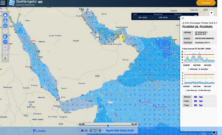
weather data normally provided for a fee, Weathernews is offering the latest vessel positions, weather and marine data, and highly localized port forecasts to help ensure safety in Middle Eastern waters. These data are powered by Weathernews’ proprietary Global Weather and Wave Forecasting System, which achieves world- class accuracy and resolution in wave and wind forecasts. The free release will continue until the current situation has stabilized and maritime safety is confirmed.
High-Accuracy Wave/Wind Forecasts Real-Time Map Sharing of Vessel Positions Near the Strait of Hormuz
Vessel and Marine Data for Middle East Waters Free of Charge on the SeaNavigator Marine Weather Service
Helping Track Vessel Cargo Status and Avoid Quay Collisions and Grounding due to Strong Winds

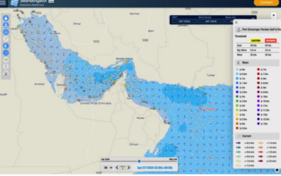

- Latest vessel position data (*1)
- Weather and marine data: global weather charts, wind direction and speed, wave direction and height, seasurface temperature, and more, with hourly forecasts up to 5 days ahead, current data, and historical data
available for viewing (updated every 4 hours)
- Highly localized port forecasts: 48-hour and 5-day forecasts for major ports such as those in the Persian Gulfarea (*2), and wave and wind forecasts up to 7 days ahead (updated every 4 hours)
- *1: Vessel position information uses MarineTraffic data provided by Kpler.
- *2: Weathernews will release data for the ports around the Persian Gulf listed below, as well as ports in the Red Sea and western India, covering approximately 140 of the roughly 2,300 ports for which Weathenews possesses data.• United Arab Emirates: Port of Abu Dhabi, Port of Dubai, Port of Fujairah, Port of Khor Fakkan, Mubarak Terminal, Fateh Terminal
• Iran: Port of Bandar Abbas, Larak Island
• Qatar: Port of Doha, Port of Ras Laffan
• Bahrain: Port of Bahrain, Port of Sitra
• Saudi Arabia: Port of Ras Tanura, Port of Jubail • Kuwait: Port of Kuwait• Iraq: Al-Basrah Oil Terminal
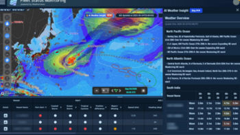
◇ SeaNavigator: An AI-Powered Marine Weather Service to Support Optimal Operational Decisions Since October 2024, Weathernews has been
providing shipping operators with SeaNavigator, an integrated marine weather service that supports environmentally sustainable, safe, and cost-efficient vessel operations. SeaNavigator is a single-platform service offering AI support before, during, and after voyages, with capabilities such as optimal route selection, CO2 emission visualization, grounding avoidance, and vessel performance analysis.
Full Features in the Paid Version of SeaNavigator
- ● AI Weather Insight: AI automatically generates weather and marine analysis and identifies vessels affected by inclement weather
- ● AI Agent: AI helps optimize operations through analysis of vast amounts of marine and voyage data
- ● Fleet Status Monitoring: Monitors the latest weather and marine data and identifies vessels affected byinclement weather
- ● Logbook+: Analyzes vessel performance based on data such as vessel reports
- ● Voyage Monitoring: Identifies risks in operational conditions
- ● Voyage Comparison: Calculates arrival times and fuel consumption by route and vessel speed to supportoptimal operations
- ● Navigation: Uses voyage plans and chart data to identify risks such as grounding
- ● Emission Dashboard: Analyzes environmental data such as CO2 emissions and fuel performance ratingsystems, among others


Related News.

Navigating the Multi-Orbit Era: In Conversation with Intellian’s Jon Harrison at SMM 2026
At SMM 2026 in Hamburg, the rapid evolution of maritime satellite communications took centre stage. Across the exhibition halls, discussions among…
Cyprus ports need joint energy and investment strategy, shipping agents chief says
Cyprus needs a coordinated strategy for shipping, energy and environmental protection to support port investment and modernisation, Cyprus shipping…

MASO Public Affairs introduces MASO Regulatory Intelligence
A new subscription service helping businesses understand what is changing and what it means for them MASO Public Affairs introduces MASO Regulatory…
Anglo-Eastern helps turn CMBTECH’s ammonia ambition into an operational reality
From early feasibility study and risk-based design to newbuilding supervision, crew readiness and technical management, Anglo-Eastern drew on its…

Escalation of attacks threatens to derail recovery in Middle East oil exports
World oil demand is forecast to fall by 2.5 mb/d y-o-y in 4Q26 and 2.6 mb/d on average in 2026. As the Iran war manifests itself through restricted…

New study finds shipping pays twice its share to EU ETS earmarked revenues should triple to help build market for sustainable fuels and technologies
Shipping is responsible for around 10% of EU ETS emissions but pays almost 20% of the ETS bill. Unlike other sectors, it has never received free…

MSARC strengthens maritime mass rescue readiness through training and national live exercise off Dakar, Senegal
Joint MSARC–FHAS programme combines three days of SAR training with a national multi-agency live exercise The Maritime Search and Rescue Council ,…

Sogese report deliveries are still being delayed as container freight rates fluctuate
FOR IMPORTERS Spot rates into the Mediterranean are back at January levels, Far East to Europe reliability sits at pandemic lows, and nearly…

Glencore begins trading on Australian Securities Exchange
Glencore has begun trading on the Australian Securities Exchange under the ASX code GLC. Gary Nagle, Glencore’s CEO, said it was an exciting day for…
BIMCO Shipping Number of the Week
Suez Canal container ship transits exceed 50% of pre-disruption levels "During the first two weeks of October, weekly container ship capacity…
Subscribe to our newsletter!
if you dont want to swim alone in the ocean of news, sign up for the newsletter, and you will receive daily all the important news of world shipping!
