TGS Completes 13-Basin Reservoir Characterisation Across 48,000+ Wells and Delivering 3,700+ Property Maps Powering Exploration and Carbon Storage Insights
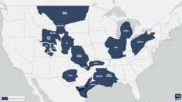

TGS has completed a multi-year reservoir characterization project across 13 U.S. basins, providing formation-level petrophysical interpretations to model reservoir performance and assess CO₂ storage feasibility.
The project delivers a comprehensive dataset resource and integrated geological frameworks that incorporate petrophysical properties, stratigraphy, and test data to enable advanced, multivariate analysis for robust decision-making for energy strategies. When combined with other TGS solutions such as Well Performance and Well Economics datasets, this resource delivers a comprehensive view of asset potential, supporting decisions from permitting and development through performance optimization and eventual abandonment.
The completed basins include: Gulf Coast, Central Gulf Coast–Haynesville, East Gulf Coast, Appalachia, Illinois, Michigan, Uinta, Piceance, Paradox, Greater Green River, Wind River, Powder River, and Greater Williston. Together, these regions represent critical areas for both conventional and emerging energy strategies.
Project Highlights:
- 48,000+ wells analyzed with full petrophysical interpretation calibrated to core data for maximum accuracy
- Integrated stratigraphic frameworks across 340 formations were evaluated, delivering basin-wide geological consistency and detailed reservoir characterization for cross-basin comparisons
- Over 3,700 regional property maps covering petrophysical attributes like porosity, permeability, pressure, and CO2 storage capacity trends for major reservoirs
- Advanced data integration including inferred curves, bottom-hole temperatures, core, and wireline formation tests for robust modeling and calibration
David Hajovsky, Executive Vice President of Multi-Client at TGS, stated “Our customers demand precision and scalability, and this dataset delivers both. With over 48,000 wells, 340 formations, and thousands of property maps calibrated to core, temperature, and pressure data, we’ve created a resource that integrates seamlessly into existing workflows and accelerates evaluations across multiple energy strategies.”
Built for technical rigor and scalability, this dataset supports increasing pressure to make faster, more informed decisions in a complex subsurface environment by delivering integration-ready data for workflows ranging from conventional exploration to carbon capture and storage planning. This dataset positions TGS at the forefront of subsurface intelligence, delivering the foundation for next-generation multivariate analytics that will drive smarter exploration, optimize carbon storage strategies, and support the industry’s needs as operators navigate the future of energy.
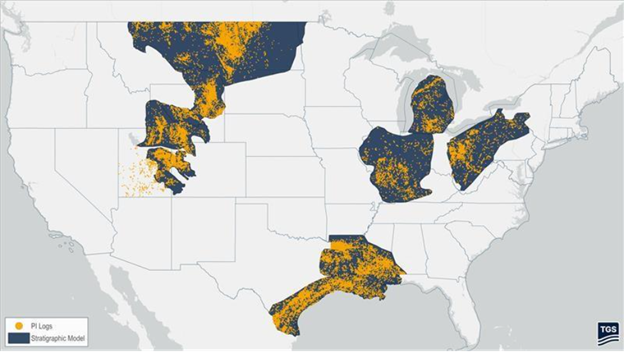
U.S. coverage of 48,000+ stratigraphic and petrophysical interpretation wells across 13 basins for this initiative.



Related News.

Navigating the Multi-Orbit Era: In Conversation with Intellian’s Jon Harrison at SMM 2026
At SMM 2026 in Hamburg, the rapid evolution of maritime satellite communications took centre stage. Across the exhibition halls, discussions among…

Cyprus ports need joint energy and investment strategy, shipping agents chief says
Cyprus needs a coordinated strategy for shipping, energy and environmental protection to support port investment and modernisation, Cyprus shipping…

MASO Public Affairs introduces MASO Regulatory Intelligence
A new subscription service helping businesses understand what is changing and what it means for them MASO Public Affairs introduces MASO Regulatory…

Anglo-Eastern helps turn CMBTECH’s ammonia ambition into an operational reality
From early feasibility study and risk-based design to newbuilding supervision, crew readiness and technical management, Anglo-Eastern drew on its…

Escalation of attacks threatens to derail recovery in Middle East oil exports
World oil demand is forecast to fall by 2.5 mb/d y-o-y in 4Q26 and 2.6 mb/d on average in 2026. As the Iran war manifests itself through restricted…

New study finds shipping pays twice its share to EU ETS earmarked revenues should triple to help build market for sustainable fuels and technologies
Shipping is responsible for around 10% of EU ETS emissions but pays almost 20% of the ETS bill. Unlike other sectors, it has never received free…

MSARC strengthens maritime mass rescue readiness through training and national live exercise off Dakar, Senegal
Joint MSARC–FHAS programme combines three days of SAR training with a national multi-agency live exercise The Maritime Search and Rescue Council ,…
Sogese report deliveries are still being delayed as container freight rates fluctuate
FOR IMPORTERS Spot rates into the Mediterranean are back at January levels, Far East to Europe reliability sits at pandemic lows, and nearly…

Glencore begins trading on Australian Securities Exchange
Glencore has begun trading on the Australian Securities Exchange under the ASX code GLC. Gary Nagle, Glencore’s CEO, said it was an exciting day for…
BIMCO Shipping Number of the Week
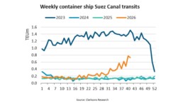
Suez Canal container ship transits exceed 50% of pre-disruption levels "During the first two weeks of October, weekly container ship capacity…
Subscribe to our newsletter!
if you dont want to swim alone in the ocean of news, sign up for the newsletter, and you will receive daily all the important news of world shipping!
