Spire Global Selected by GIST Research to Provide Soil Moisture Data for Climate and Conflict Early Warning Research in Ethiopia’s Somali Region


Supported by the International Organization for Migration (IOM), the project uses satellite-based soil moisture insights to strengthen early warning systems in one of Africa’s most climate-exposed regions
Spire Global, Inc., a global provider of space-based data, analytics, and space services, today announced it was selected by GIST Research (GIST), an independent research and advisory consultancy specializing in fragile and climate-affected contexts, to provide its Soil Moisture Insights for a study mapping climate-driven pastoralist movement in Ethiopia’s Somali Region. The data will feed into the International Organization for Migration’s (IOM) Transhumance Tracking Tool (TTT), a system designed by the UN Agency to observe herder movements and mitigate conflict risks.
Supported by IOM, with funding from the Central Emergency Response Fund (CERF), the pilot aims to strengthen early warning systems that monitor environmental and livelihood stress in one of Africa’s most climate-exposed regions, where scarce resources can heighten competition and foster tension between pastoralist communities. The resulting insights are expected to inform evidence-based policies, guide authorities and partners in their interventions, and contribute to conflict prevention efforts.
Pastoral communities in Ethiopia’s Somali Region have long relied on mobility to sustain their herds, moving in search of rainfall, pasture, and water. Increasing climate variability is making these movements less predictable, with changing rainfall patterns shaping when and where herders travel.
Utilizing five years of Spire’s high-resolution Soil Moisture Insights, GIST, in collaboration with IOM, combined in-depth field research and extensive on-the-ground consultations to map out conflict dynamics and trace how rainfall, water, and soil conditions influence pastoralist mobility across thousands of kilometers of rangeland. The findings highlight how soil moisture fluctuations shape herd movements and how space-based data can visualize the same environmental signals that pastoralists have long used to decide where to move next, following the clouds in search of rain and fresh pasture.
“The communities we speak with often describe their choice to move as ‘following the clouds,’” said Romain Galgani, Senior Research Lead at GIST. “With satellite observations, we’re able to use technology to carry that tradition forward: studying and analyzing the same patterns through data and helping translate them into information that supports timely, local decisions.”
“Pastoral mobility is one of the oldest forms of climate adaptation,” said Sascha Nlabu, IOM Ethiopia Head of Programmes. “Across the Somali Region, herders depend on rapid decisions about when and where to move livestock. By reinforcing that intuition with reliable data, we are bridging centuries-old knowledge with modern satellite technology.”
“This collaboration is a powerful example of how our space-based data can help people and organizations act sooner, not later,” said Theresa Condor, Chief Executive Officer at Spire Global. “When we can turn near-real-time soil moisture signals into decisions that protect livelihoods, we move from monitoring the planet to truly empowering those living through its changes.”
GIST and IOM are developing an interactive early-warning dashboard, powered by live Soil Moisture Insights from Spire, to map pastoral routes and ecological risks in real time, providing communities and organizations with a new tool to prepare for drought. This collaboration will enable the development of a mobility-sensitive early warning system that blends local knowledge with high-resolution satellite data to strengthen resilience and inform anticipatory action for pastoralist communities. The dashboard builds on GIST data analytics and predictive modeling capabilities. It serves as a proof of concept for how satellite-derived soil-moisture insights can enhance existing early-warning systems and enable faster, more localized decision-making before drought or displacement take hold.
Spire’s Soil Moisture Insights deliver near-real-time readings of how wet or dry the ground is across every corner of the globe. Derived from the Company’s fully deployed constellation of dual use satellites, the data penetrates cloud cover and darkness to reveal subsurface conditions at up to 100-meter resolution. From drought forecasting and flood monitoring to agriculture and supply-chain resilience, Spire’s soil-moisture measurements are helping organizations anticipate change, protect resources, and adapt to a rapidly shifting planet.
Source: BUSINESS WIRE



Related News.

Hong Kong Global Maritime Trade Summit to return for third edition
The International Chamber of Shipping, in collaboration with the Transport and Logistics Bureau of the Government of Hong Kong and the Hong Kong…

Appetite for US crude oil exports climbs despite high freight
South Korea tops US crude destinations at 568,600 b/d VLCC rates to Asia double, closing arbitrage window European refining margins…

Shipping stocks Rally as Hormuz Traffic plunges 75%
Ship traffic through the Strait of Hormuz — a critical chokepoint handling about 20% of global crude oil and liquefied natural gas shipments — has…

Diana Shipping announces Time Charter Contract for m/v G P Zafirakis with Classic Maritime
Diana Shipping, a global shipping company specializing in the ownership and bareboat charter-in of dry bulk vessels, announced that, through a…

New IMO ESP Code framework for Remote Inspection Techniques
The International Maritime Organisation, through Resolution MSC.584(111) , has adopted amendments to the International Code on the Enhanced…

ABS opens Offshore & Marine Support Center in Bergen
ABS has expanded its capabilities in the Norwegian maritime market with the opening of a cutting-edge support center in Bergen, bringing advanced…

MOL holds giant step memorial ceremony and beach cleanup at Kashima Coast
Memorial and Reflection 20 Years After the Accident: Learning from the Past to Foster an Even Stronger Safety Culture Mitsui O.S.K. Lines, announced…
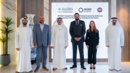
KEZAD-based Arabian Gulf Steel Industries achieves lowest verified Carbon Footprint for Rebar
CARES UK verified Environmental Product Declaration confirms 139 kg CO₂e per tonne for rebar produced at AGSI’s KEZAD Abu Dhabi facility Arabian…

Indian Register of Shipping announces launch of first fleet support ship INS Surya
Indian Register of Shipping continues to strengthen its role in supporting the Indian Navy and India’s naval shipbuilding capabilities through the…

VLCCs Climbing the Record Charts
LR2 The TC1 75kt MEG/Japan index decreased by only a single point this week to WS928. The corresponding Baltic round-trip TCE fell by $2,000 to…
Subscribe to our newsletter!
if you dont want to swim alone in the ocean of news, sign up for the newsletter, and you will receive daily all the important news of world shipping!
