Drone Application Map Tool Market Analysis Report 2025-2035: Move Toward Automation and Autonomous Operations, and Increased Integration with IoT and Other AgTech Tools – ResearchAndMarkets.com


The “Drone Application Map Tool Market – A Global and Regional Analysis: Focus on Application, Product, and Regional Analysis – Analysis and Forecast, 2025-2035” report has been added to ResearchAndMarkets.com’s offering.
The report values the market at $1.19 billion in 2025, rising to $10.75 billion by 2035 at a CAGR of 24.53%, driven by escalating infrastructure spend, reuse projects, and sustainability mandates.
Drone application map tools comprise a fast-growing segment of the precision agriculture market, offering farmers and agronomists a way to survey and analyze crops with unprecedented speed and detail. These tools consist of software and hardware solutions that convert drone-captured images into digital maps, agronomic insights, and variable-rate application instructions, thereby enabling data-driven farm management.
Global demand for drone mapping solutions is accelerating as the agriculture sector faces mounting pressure to increase productivity and sustainability. Farmers are embracing these tools to optimize inputs and reduce crop losses. For example, drones can quickly identify pest outbreaks or nutrient deficiencies in a field, enabling targeted treatment that boosts yields and reduces costs.
The integration of drone mapping outputs with existing AgTech tools has deepened; modern mapping software often syncs with farm management information systems (FMIS), allowing prescription maps to be exported directly to GPS-guided tractors and sprayers for automated variable-rate application. Emerging technology trends in the industry include the move toward real-time in-field processing, which allows maps to be generated on the fly during drone missions. Additionally, IoT sensor fusion combines drone data with ground sensor readings to provide a more comprehensive picture of field conditions.
There is also a push to develop affordable hyperspectral cameras and other advanced sensors, which have historically been costly, to broaden their adoption in crop analysis. These innovations are making drone mapping tools more powerful and user-friendly, thereby accelerating their adoption in precision agriculture. In summary, the industry is leveraging rapid advances in UAV technology, cloud computing, and AI to deliver highly sophisticated yet accessible mapping solutions that are revolutionizing how agricultural land is monitored and managed.
However, adoption of these solutions remains uneven; smaller and resource-constrained farms, as well as developing regions, often lag in uptake due to concerns about cost, lack of drone operation expertise, or regulatory limitations on UAV flights. In such environments, traditional practices or satellite imagery still dominate, and the benefits of drone mapping have yet to be fully realized. Addressing these gaps through training, service-provider models, and supportive policies will be key to unlocking the market’s full potential.
Key Market Players and Competition Synopsis
The global drone application map tool market is characterized by a mix of specialized software providers and integrated agritech companies vying to offer the most comprehensive precision mapping solutions. Leading players, such as Pix4D, DroneDeploy, and Sentera (now part of John Deere), have captured significant market share by combining robust photogrammetry engines with advanced agronomic analytics. Competition is fierce, with established firms continuously innovating to differentiate themselves through technology, for example, by offering AI-driven analysis or onboard/edge processing for real-time results, and expanding their geographic reach into new agricultural regions.
The depth of software integration has become a key battleground; some platforms remain standalone mapping tools, while others deeply integrate with farm management systems and machinery for seamless data flow. These top firms are investing heavily in R&D (cloud processing, multi-sensor integration, and machine learning) to stay ahead even as hardware leaders like DJI and Parrot provide affordable drone platforms that complement the software ecosystems. Overall, the competitive landscape is dynamic and innovation-driven, with companies racing to deepen software integration, form strategic alliances, and expand their regional presence to meet the growing demand for drone-based mapping in agriculture and beyond.
Key Attributes:
| Report Attribute | Details |
| No. of Pages | 168 |
| Forecast Period | 2025 – 2035 |
| Estimated Market Value (USD) in 2025 | $1.19 Billion |
| Forecasted Market Value (USD) by 2035 | $10.75 Billion |
| Compound Annual Growth Rate | 24.5% |
| Regions Covered | Global |
Market: Industry Outlook
Trends: Current and Future Impact Assessment
- Move toward Automation and Autonomous Operations
- Increased Integration with IoT and Other AgTech Tools
Market Drivers
- Ease of Surveillance, Scouting, and Insurance Validation
- Regulatory Support for Digital Farming
Market Restraints
- Highly Dependent on Drone Adoption
- Farm Internet Connectivity Issues
Market Opportunities
- Drone-as-a-Service Model for Small and Medium Farms
- Integration of AI and Machine Learning for Crop Analytics
- Carbon Farming Verification and Environmental Compliance Mapping
Emerging Technologies and Long-Term Adoption Path
- Real-Time Mapping Drones
- IoT Sensor Fusion
- Instant Weed Identification through Artificial Intelligence
- Affordable Hyperspectral Payloads
- Software Landscape and Improvement Areas
- Developing-Region Adoption Outlook
- Asia-Pacific Market Leadership and Government Support
- Latin American Commercial Agriculture Integration
- Rest-of-the-World Infrastructure and Development Challenges
Imaging Technologies
- RGB Imaging
- Near-Infrared Imaging
- Multispectral Imaging
- Hyperspectral Imaging
- Thermal Infrared Imaging
- LiDAR Technology
Companies Featured
- Pix4D
- DroneDeploy
- Agisoft
- Sentera, Inc.
- ESRI
- Aerobotics (Pty) Ltd.
- Hummingbird Technologies
- Hiphen Technologies
- Farmonaut Technologies Private Limited
- OpenDroneMap, Inc.
- SPH Engineering LLC
- DroneMapper LLC
- Maps Made Easy, Inc.
- SimActive Inc.
- FlyPard Analytics GmbH
For more information about this report visit https://www.researchandmarkets.com/r/h829wi
Source: BUSINESS WIRE



Related News.

Navigating the Multi-Orbit Era: In Conversation with Intellian’s Jon Harrison at SMM 2026
At SMM 2026 in Hamburg, the rapid evolution of maritime satellite communications took centre stage. Across the exhibition halls, discussions among…

Cyprus ports need joint energy and investment strategy, shipping agents chief says
Cyprus needs a coordinated strategy for shipping, energy and environmental protection to support port investment and modernisation, Cyprus shipping…

MASO Public Affairs introduces MASO Regulatory Intelligence
A new subscription service helping businesses understand what is changing and what it means for them MASO Public Affairs introduces MASO Regulatory…

Anglo-Eastern helps turn CMBTECH’s ammonia ambition into an operational reality
From early feasibility study and risk-based design to newbuilding supervision, crew readiness and technical management, Anglo-Eastern drew on its…

Escalation of attacks threatens to derail recovery in Middle East oil exports
World oil demand is forecast to fall by 2.5 mb/d y-o-y in 4Q26 and 2.6 mb/d on average in 2026. As the Iran war manifests itself through restricted…

New study finds shipping pays twice its share to EU ETS earmarked revenues should triple to help build market for sustainable fuels and technologies
Shipping is responsible for around 10% of EU ETS emissions but pays almost 20% of the ETS bill. Unlike other sectors, it has never received free…

MSARC strengthens maritime mass rescue readiness through training and national live exercise off Dakar, Senegal
Joint MSARC–FHAS programme combines three days of SAR training with a national multi-agency live exercise The Maritime Search and Rescue Council ,…
Sogese report deliveries are still being delayed as container freight rates fluctuate
FOR IMPORTERS Spot rates into the Mediterranean are back at January levels, Far East to Europe reliability sits at pandemic lows, and nearly…

Glencore begins trading on Australian Securities Exchange
Glencore has begun trading on the Australian Securities Exchange under the ASX code GLC. Gary Nagle, Glencore’s CEO, said it was an exciting day for…
BIMCO Shipping Number of the Week
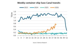
Suez Canal container ship transits exceed 50% of pre-disruption levels "During the first two weeks of October, weekly container ship capacity…
Subscribe to our newsletter!
if you dont want to swim alone in the ocean of news, sign up for the newsletter, and you will receive daily all the important news of world shipping!
