Fugro to update Cayman Islands hydrography for UKHO with carbon-neutral survey
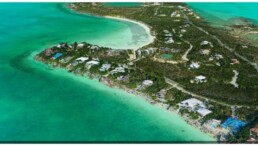
The UK Hydrographic Office has selected Fugro to survey a 515 km2 area over the Cayman Islands in November.
The project will support updated nautical charting and improved coastal zone management. To accomplish the work, Fugro will deploy their Rapid Airborne Multibeam Mapping System (RAMMS), a solution that meets International Hydrographic Organization (IHO) quality and accuracy standards, while also contributing to UKHO’s goals for carbon neutral operations.
Fugro has successfully used RAMMS on four projects for UKHO since commercialising the system in 2018. Compact and weighing only 30 kg, it is an efficient and cost-effective alternative to traditional airborne lidar bathymetry (ALB) systems. Fugro estimates that using RAMMS on the Cayman Islands project will reduce carbon emissions by 80 % compared to legacy ALB sensors. The company will apply additional carbon mitigation strategies to bring the project’s total environmental impact to ‘net zero’.
“UKHO helped inspire Fugro’s development of RAMMS by challenging industry to improve the efficiency and quality of ALB data, so we are proud to take these gains a step further with delivery of our first carbon neutral survey,” said Edward Saade, President of Fugro in the US. “We look forward to celebrating the results of this collaboration in the months to come and we thank UKHO for their leadership and partnership in moving the hydrographic community forward toward a more sustainable future.”


Related News.

Navigating the Multi-Orbit Era: In Conversation with Intellian’s Jon Harrison at SMM 2026
At SMM 2026 in Hamburg, the rapid evolution of maritime satellite communications took centre stage. Across the exhibition halls, discussions among…
Cyprus ports need joint energy and investment strategy, shipping agents chief says
Cyprus needs a coordinated strategy for shipping, energy and environmental protection to support port investment and modernisation, Cyprus shipping…

MASO Public Affairs introduces MASO Regulatory Intelligence
A new subscription service helping businesses understand what is changing and what it means for them MASO Public Affairs introduces MASO Regulatory…
Anglo-Eastern helps turn CMBTECH’s ammonia ambition into an operational reality
From early feasibility study and risk-based design to newbuilding supervision, crew readiness and technical management, Anglo-Eastern drew on its…

Escalation of attacks threatens to derail recovery in Middle East oil exports
World oil demand is forecast to fall by 2.5 mb/d y-o-y in 4Q26 and 2.6 mb/d on average in 2026. As the Iran war manifests itself through restricted…
New study finds shipping pays twice its share to EU ETS earmarked revenues should triple to help build market for sustainable fuels and technologies
Shipping is responsible for around 10% of EU ETS emissions but pays almost 20% of the ETS bill. Unlike other sectors, it has never received free…
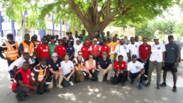
MSARC strengthens maritime mass rescue readiness through training and national live exercise off Dakar, Senegal
Joint MSARC–FHAS programme combines three days of SAR training with a national multi-agency live exercise The Maritime Search and Rescue Council ,…
Sogese report deliveries are still being delayed as container freight rates fluctuate
FOR IMPORTERS Spot rates into the Mediterranean are back at January levels, Far East to Europe reliability sits at pandemic lows, and nearly…
Glencore begins trading on Australian Securities Exchange
Glencore has begun trading on the Australian Securities Exchange under the ASX code GLC. Gary Nagle, Glencore’s CEO, said it was an exciting day for…
BIMCO Shipping Number of the Week
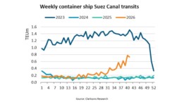
Suez Canal container ship transits exceed 50% of pre-disruption levels "During the first two weeks of October, weekly container ship capacity…
Subscribe to our newsletter!
if you dont want to swim alone in the ocean of news, sign up for the newsletter, and you will receive daily all the important news of world shipping!
